Category Archives: Mapping / Geospatial

Mapping Unimproved Roads

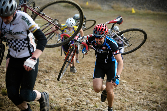
Cyclocross is a one of those weird sports I’d never heard of until I moved to Portland. Essentially cyclocross is a form of bike racing that entails riding on pavement, trails and grass while occasionally dismounting to carrying your bike … finish reading Mapping Unimproved Roads

Posted in Data Visualization, General Instructional Technology, Mapping / Geospatial | Comments Off on Mapping Unimproved Roads

Curricular guidance from social media: #gistribe in action

For the past two years, I have presented a GIS/mapping workshop as part of Paideia — in 60-ish minutes, aiming to give the Reed community an introduction into the concepts of spatial analysis, basic cartography and critical map reading, and … finish reading Curricular guidance from social media: #gistribe in action

Posted in Mapping / Geospatial, Workshops | Tagged , , , , , , | Comments Off on Curricular guidance from social media: #gistribe in action

A few of my favorite (mapping) things

Fall break is here, and I expect Portland fall weather to set in any minute now. In anticipation of hunker-down-and-curl-up weather, here’s a handful of geospatial delights that might pair well with a hot mug of something and grey skies: … finish reading A few of my favorite (mapping) things

Posted in Mapping / Geospatial | Comments Off on A few of my favorite (mapping) things

Getting on the map (workshop)

On May 29th/30th, Reed is co-hosting the inaugural instructional technology conference of the Northwest Five Consortium (NW5C). I am leading a workshop on maps, mapping, spatial analysis, and spatial thinking; materials below. Hands-on #1: Social Explorer (instructions) (website) Hands-on #2: … finish reading Getting on the map (workshop)

Posted in Mapping / Geospatial, Workshops | Comments Off on Getting on the map (workshop)

Geocoding

Recently, I have been assisting several students with geocoding projects for their classes and thesis projects, using geocoding functionality in R. To document this work I have put together several tutorials and resources for students and faculty to use.

Posted in Data Visualization, Mapping / Geospatial, Quantitative analysis | Tagged | Comments Off on Geocoding

Workshop: Spatial Analysis + Mapping, Paideia 2015

I’ll be leading a one-hour intro to GIS, mapping, and geospatial analysis on Friday, 1/22, from 9-10 in ETC 205. Come join! Materials from the workshop are here (Mapping_GIS_Paideia). Download the zipped file to your desktop and unzip it – open datafiles … finish reading Workshop: Spatial Analysis + Mapping, Paideia 2015

Posted in Mapping / Geospatial, Workshops | Tagged , , , | Comments Off on Workshop: Spatial Analysis + Mapping, Paideia 2015

FOSS4G: Geospatial tech, community, and a bird named Helen

I recently returned from a week of workshops, presentations, networking, and general nerdery with an incredible group of people: open source geospatial developers, users, and other spatially-focused folk from across the globe.

Posted in Mapping / Geospatial | Tagged , | Comments Off on FOSS4G: Geospatial tech, community, and a bird named Helen

Spatial proximity and Reed’s smoking policy

Last year, Reed re-examined its smoking policy, which touched off some fairly spirited debates around campus. The revised policy is now in place, and you can see structures around campus to provide simultaneous shelter from the rain and access to … finish reading Spatial proximity and Reed’s smoking policy

Posted in Mapping / Geospatial | Tagged , , , | Comments Off on Spatial proximity and Reed’s smoking policy

Choropleth Maps

Posted in Data Visualization, Mapping / Geospatial, Quantitative analysis | Tagged | Comments Off on Choropleth Maps

The future of GIS in education and research (UCGIS, 2014)

While proud families and supportive friends watched the Reed College Class of 2014 officially transition to alumni, I headed to Pasadena for the 2014 UCGIS* conference. As folks chatted at pre-conference workshops** and the opening reception, I slowly realized that … finish reading The future of GIS in education and research (UCGIS, 2014)

Posted in Mapping / Geospatial | Tagged | Comments Off on The future of GIS in education and research (UCGIS, 2014)